Whether in the car, on the mobile or in surgery: navigation systems, once domains of military use, are today a mass market. And not least due to the convergence of the American system on global positioning GPS with the European satellite system Galileo it is possible today to determine the position of objects with a size of only a few centimeters from space. And in doing so with a precision bordering on a miracle.
And it is to become even more precise. To achieve this, influencing factors have to be eliminated that up to now carried little weight. For example signal dispersion: satellite signals penetrate the earth’s atmosphere, meaning there where our weather is determined, and spread out more slowly than in a vacuum. This delay can indeed be taken into account with the aid of correction models; however a residual error remains that impairs the geodetic results. “That is why we are looking for better correction models”, is how Professor Hobiger describes one of his research goals.
The convergence of various satellite systems to make a Global Navigation Satellite System (GNSS) also poses a challenge: besides GPS and Galileo the systems Beidou (China) and GLONASS (Russia) as well as various add-on systems are also included. They all transmit different signals at different frequencies, making joint use difficult. “In order to correct the errors thereby occurring, a fundamental understanding of the systems is required“, said Professor. “We want to refine this.“
Navigation as a multi-tool
But Professor Hobiger also wants to penetrate completely new areas of navigation. “Currently we are experiencing a shift from hardware to software“, said the geodesist and geophysicist. “This opens up new possibilities for science using simple means.“ In this respect, for example, raw data from a mobile phone could be used in order to determine the weather or to characterize the environment.
When determining the position of vehicles, data from components that is installed in the car itself, for example on wheel and distance sensors or the accelerometers, has long been used in addition. “If there is no acceleration, the car must continue to be driven at a constant speed“, explained Professor Hobiger. “The change in position can be calculated from this, even when the clear view of a satellite is blocked because the car is currently being driven through a tunnel.“ In the case of longer tunnels this does not yet work so well because the vehicle drifts away from the calculated axis with increasing distance”, the scientist admitted. “Therefore we are developing sensors that suppress such system effects.“
Here in Stuttgart there is strong aerospace beyond geodesy and the industrial environment is also fitting
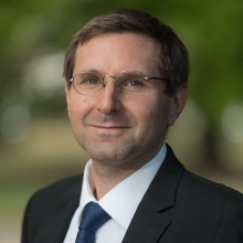
Prof. Thomas Hobiger, Head of Institute of Navigation
Focus autonomous driving
These considerations are particularly relevant in the case of the major future topic of autonomous driving. The car is already increasingly becoming a complex system that communicates with other vehicles or objects in the environment, for example traffic lights. These systems are particularly challenged with autonomous driving. “For self-driving cars positioning and navigation has to be so precise that the vehicle is kept exactly in its lane“, Professor Hobiger clarified, “and even if the lane is narrow due to a road works”.
However, navigation data also plays a role in areas in which we wouldn’t expect it. Namely when it concerns the factor of time. At the stock exchange, for example, where the price of a bond is determined exactly at the time of a purchase or a sale and milliseconds decide about millions. These time specifications are also based on GNSS data. And they have to be extremely reliable. The topic of timing is therefore another of the scientist’s research aspects.
Besides questions of classic navigation, the theory and the mathematical approach as well as the cross-sectional field of autonomous driving, Professor Hobiger would also like to research the navigation of small satellites. Stuttgart is the perfect place for this, said the native Austrian, who researched for ten years in Japan and latterly four years at Chalmers University of Technology in Sweden. “Here in Stuttgart there is strong aerospace beyond geodesy and the industrial environment is also fitting.“
Flipped classroom
The international presence of the researcher is also to benefit the students. “At Chalmers the emphasis is on problem-oriented learning, i.e. away from classic examinations towards more project work in groups“, reported Professor Hobiger, who would also like to refine this approach in der Stuttgart. Just like the “flipped classroom“. This concept sees a lecture being filmed in the first year, discussed in the following year during the lecture period on the basis of the video. “This is indeed more time consuming for the students since they have to learn the material from the video outside of the lecture. But the concept leads to very good learning successes, above all in higher semesters.“
Prestigious award
As only recently became known, the American Geophysical Union will be presenting Professor Hobiger with the prestigious Geodesy Section Award in 2018 in December of this year for his research achievements as well as his commitment to teaching and PR work. Among the range of geodesists awarded this honor, he is the first one working in Germany.


